

Cities of the World [1617/2015] – ★★★★1/2
“Travelling – it gives you home in thousand strange places, then leaves you a stranger in your own land” (Ibn Battuta (1303 – 1377), a Berber Maghrebi scholar and explorer, who “travelled more than any other explorer in pre-modern history”, covering some 117.000 km over a 30 year-long journey).
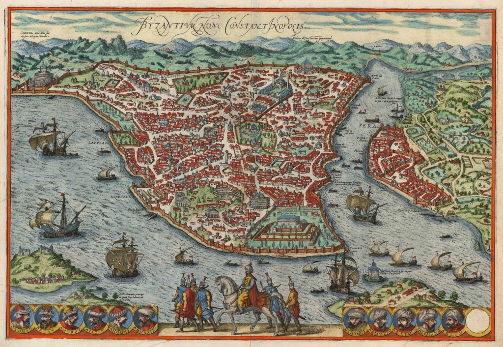
This Taschen edition encyclopaedic book compiles engravings and original texts with commentaries from the Civitates orbis terrarum, a collection of town maps produced between 1572 and 1617 by Frans Hogenberg, a Flemish engraver, and Georg Braun, a German Catholic cleric, among other contributors. The book is often referred to as “the most important cartographic work of sixteenth-century Europe”, and includes town plans, bird’s-eye views of cities and stunning landscape illustrations of various cities’ domestic activities. Since these date from the sixteenth century and come from European authors, the book naturally talks predominantly about the cities of Europe (though it does include such cities as Constantinople (Istanbul), Cairo, Alexandria, Jerusalem, Cuzco and Mexico City, too), and retains its original title – Cities of the World. Below are just snippets from this fascinating illustrated book that spans some 750 pages and covers more than 450 cities.
The first 60 pages of this book is the detailed historical exposition of how Civitates orbis terrarum came about, including the talk about its textual sources and previous achievements in mapping cities, for example, The Nuremberg Chronicle was published in 1493, providing an overview of world history with woodcut illustrations of various cities, including Florence and Constantinople. Frans Hogenberg and Georg Braun’s Cities of the World does not merely focus on cities, but also talks about some notable architectural examples, and, in that vein, it is interesting to see how cities, their topography and landmarks changed (or not) through history. For example, through the maps, we can glimpse the ocean-going history of German town Bremen and the consequences of Attila the Hun’s capture of Italy’s Milan. Cadiz, Toledo, Rome, Orleans, Lyon, Vienne, Luxembourg, London and Canterbury are just a few of the cities included that I particularly enjoyed exploring through this book. It was interesting for me to learn about the history of the now-gone Temple of Artemis in Korkyra (now city of Corfu), in Greece, and to find out that Canterbury was originally a Roman city called Durovernum Cantiacorum, that Bilbao was called Bellum Vadum (Beautiful Ford) Bilvao, and that Barcelona was named Faventia by the Romans.
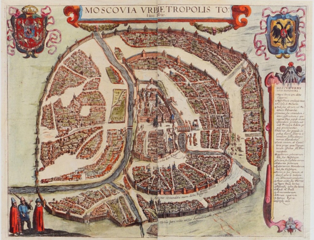
The map of Moscow and the provided sixteenth-century text are equally illuminating. First of all, the sixteenth century authors refer to Moscow (Moskva) as the capital of the whole of White Russia. This is indeed where Moscow was believed to reside in the sixteenth century – in White Russia, as Alexnder Guagnini’s sixteenth century book also states that Rus’ was divided into three parts: White Russia governed by the Muscovite Grand Duke – with Moscow in its centre, Black Russia, being under the Polish rule, and Red Ruthenia, referring to the country’s south-western principalities. The Kremlin, the Red Square and even the Saint Basil’s Cathedral (completed in 1561) are all can be discerned on the map provided. The main river of Moscow is Moskva (Moscow-River), but our sixteenth century guides tell us that another openly flowing river is just as important – river Neglina, that cuts across the very centre of the capital. In fact, when the very first fortifications for the Kremlin were built way before 1156, it was river Neglina that acted as a moat. In our twenty-first century, Neglina, Neglinna or Neglinnaya is now an underground river of Moscow, having been completely “rebuilt” or redirected in 1792. A comparison here can be made with many now subterranean rivers of London, that were once very much overground and flowing openly, such as river Fleet, which gave its name to Fleet Street. It was once a major river, especially in Roman times and medieval Britain, but had gradually turned into a sewer.
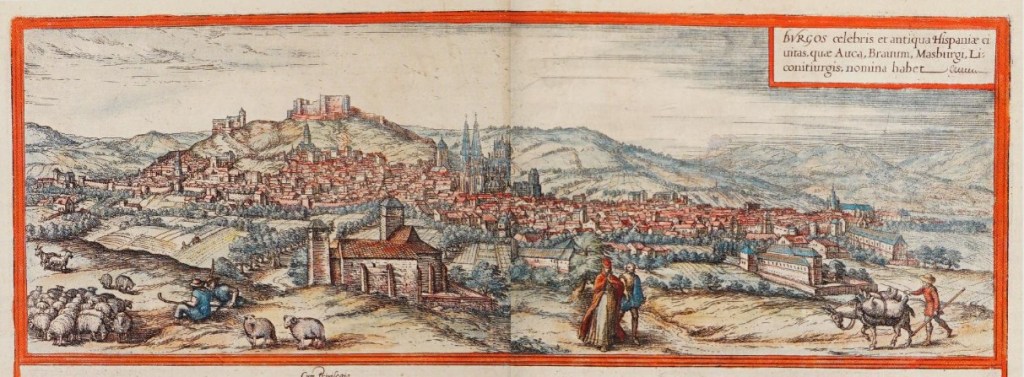
I also learnt much new information about various cities, including Ghent in Belgium, and Burgos in Spain. The latter was made the capital of the Kingdom of Castile in 1037 and is described by Braun and Hogenberg as a city of hard-working people who specialise in all kinds of arts and handicrafts, but which subsequently went through some hardship, including a plague in 1565. It is also near Burgos, in a village of Vivar, where the medieval warlord El Cid Campeador was born. Ghent in Belgium is described as possessing “20 islands, which lie in the surrounding lakes and rivers…98 bridges…and 100 windmills” [Braun and Hogenberg, Taschen Publications 2015: 111]. The history of St. Bavo’s monastery, church and then the cathedral is fascinating to read, as well as to find out that Ghent was at one point in the fourteenth century “the second- largest city in northern Europe after Paris” [ibid].
Cities of the World is a great historical resource, shedding much light on how people viewed the most important economic and cultural centres of Europe in the sixteenth century. It will definitely be a real treat for people who love all things cartography, as well as exploring the history of European cities.

My sort of book! Hope I may be able to have a dekko at this sometime soon, so thanks for drawing attention to it. 🙂
LikeLiked by 1 person
This sounds so fascinating. A wonderful way to step back in time.
LikeLiked by 1 person
Seems like such an interesting book – and beautiful too! I love looking at old maps also because of all the details that usually lack in our modern maps!
LikeLiked by 1 person
Maps are always so intriguing. 🤩
LikeLiked by 1 person