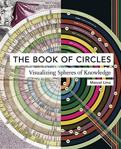
Visualizing Spheres & Branches of Knowledge: “The Book of Circles”, & “The Book of Trees”

I. The Book of Circles [2017] by Manuel Lima – ★★★★

This illustrated non-fiction is all about the human presentation of knowledge through circles. The author states how natural it is for humans to try to classify and systematise all sorts of knowledge, and the circle serves as a perfect vehicle for doing so because it is a perfect geometrical figure standing for the Sun, among other things, and representing a multitude of other concepts, including movement, unity, wholeness, perfection and infinity. Being a shape that is omnipresent in nature, the circle may also be attracting our attention because of our innate evolutionary tendency to seek out human faces/eyes.

A large chunk of this book is devoted to showing various circles being used to illustrate and explain all sorts of concepts and progressions, from the presentations of the solar system, scientific theorems and alchemical tables to city maps, world economics and online engagements. There are things in this book which I never thought have been or could have been analysed using a circle, including the “Lineage of Sin in the Bible” (2009) by Anna Filipova and the changing colour of Lego sets (2015) by David Eaton.

Continue reading “Visualizing Spheres & Branches of Knowledge: “The Book of Circles”, & “The Book of Trees””

Review: Hogenberg & Braun’s Cities of the World by Stephan Füssel (ed.)

Cities of the World by Frans Hogenberg and Georg Braun

Cities of the World [1617/2015] – ★★★★1/2

Travelling – it gives you home in thousand strange places, then leaves you a stranger in your own land” (Ibn Battuta (1303 – 1377), a Berber Maghrebi scholar and explorer, who “travelled more than any other explorer in pre-modern history”, covering some 117.000 km over a 30 year-long journey).

This Taschen edition encyclopaedic book compiles engravings and original texts with commentaries from the Civitates orbis terrarum, a collection of town maps produced between 1572 and 1617 by Frans Hogenberg, a Flemish engraver, and Georg Braun, a German Catholic cleric, among other contributors. The book is often referred to as “the most important cartographic work of sixteenth-century Europe”, and includes town plans, bird’s-eye views of cities and stunning landscape illustrations of various cities’ domestic activities. Since these date from the sixteenth century and come from European authors, the book naturally talks predominantly about the cities of Europe (though it does include such cities as Constantinople (Istanbul), Cairo, Alexandria, Jerusalem, Cuzco and Mexico City, too), and retains its original title – Cities of the World. Below are just snippets from this fascinating illustrated book that spans some 750 pages and covers more than 450 cities.

Continue reading “Review: Hogenberg & Braun’s Cities of the World by Stephan Füssel (ed.)”